25/06/2023
Preparing Self-Driving Cars for Deployment in Washington, DC
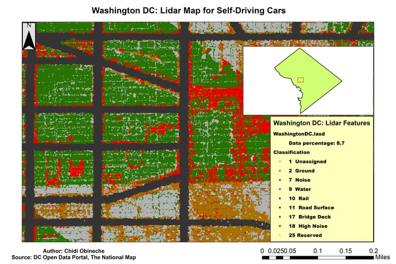
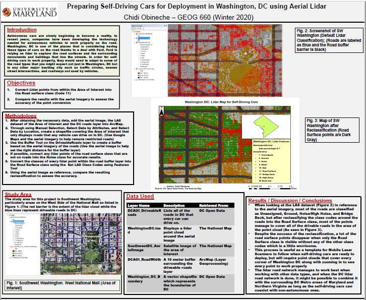
The purpose of this project was to create an aerial lidar road template that autonomous vehicles can use when they are ready to be deployed in Washington, DC. It mainly focused on an area in Southwest Washington, but could apply to the entire DC Metro Area. By using a 10-meter buffer around DC Public Roads and changing the LAS Class codes of lidar points within the buffer into the Road Surface Class, I was able to create a lidar road network.
Car Crash Risk Areas in Maryland
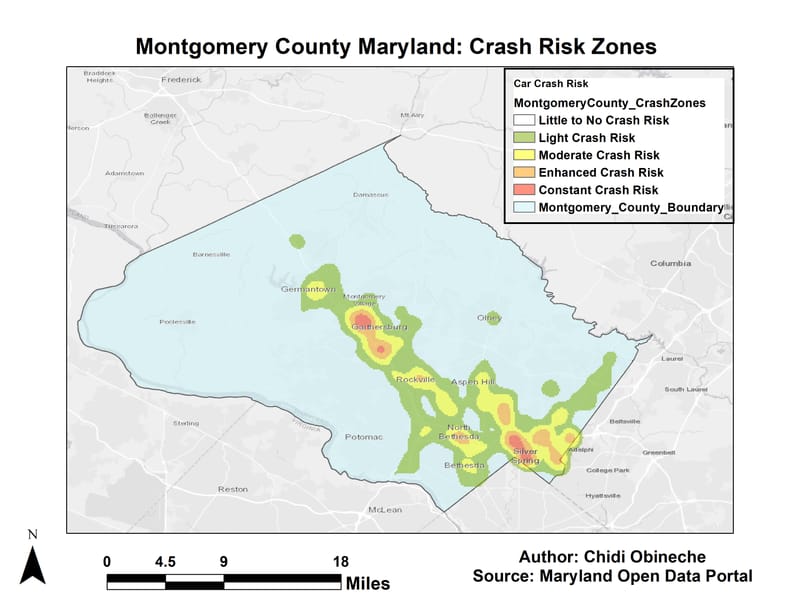
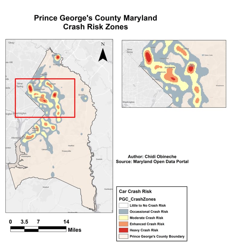
With the country slowing rising from the COVID-19 pandemic, we are seeing more cars return to the road. There are also the potential for a lot of car crashes, especially with the rise of carjackings. I wanted to see which areas in various parts of Maryland were the most prone to have car crashes based on the car crash data collected in 2022. I mainly focused on Montgomery County and Prince George's County and it looks like a lot of the high risk zones for car crashes were located in the southern and central areas of Montgomery County (Gaithersburg, Silver Spring, Bethesda) and the western and northern areas of Prince George's County near Washington (Adelphi, Laurel, Hyattsville)
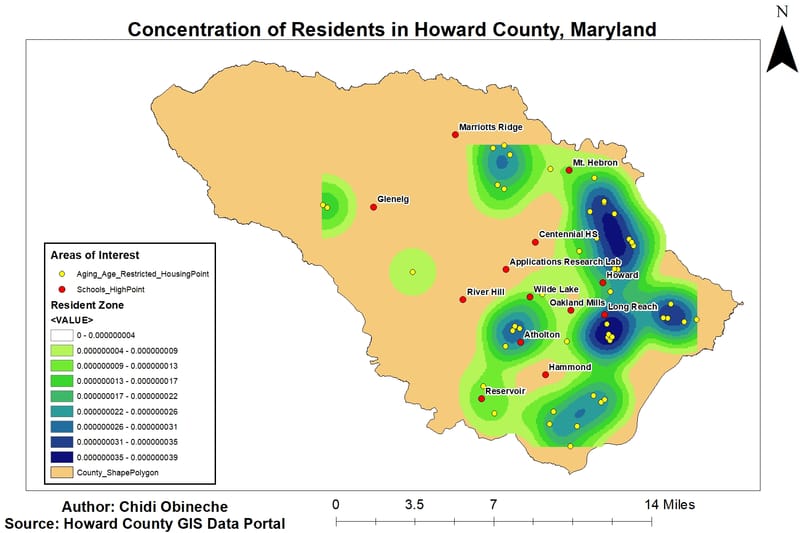
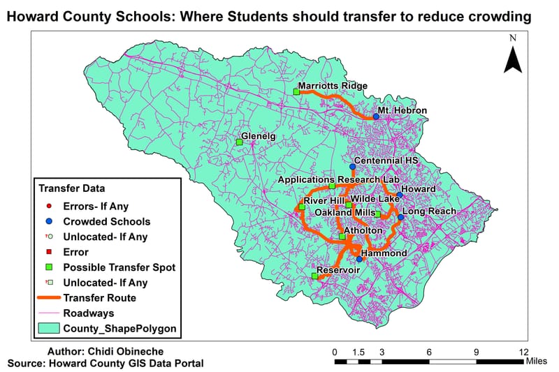
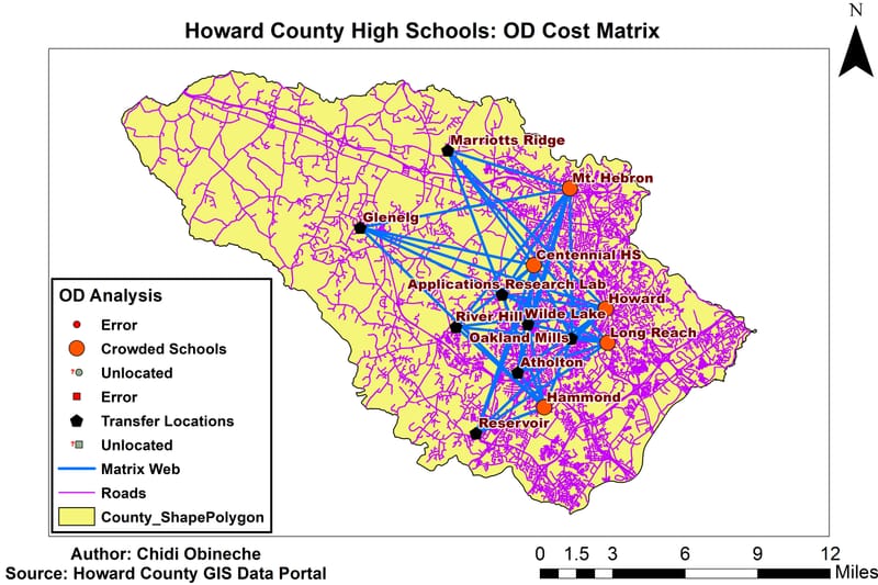
High School Crowding in Howard County, Maryland
As my first graduate GIS project, I was curious about the issue of overpopulation in high schools in Howard County, Maryland. Through the use of Kernel Density Analysis and Network Analysis (Closest Facility Analysis and Origin-Destination Cost Matrix) I was able to find possible schools that students can transfer to reduce crowding in the five most crowded high schools in the county (Centennial, Howard, Long Reach, Hammond, and Mt. Hebron).
Web Courses in Transportation Planning
I slowly began to realize that I have a keen interest in transportation planning, and I started to take web courses that can help me discover how GIS can possibly work in Transportation Planning. I have taken a few courses provided by the National Center for Applied Transit Technology and Udemy. I was even able to start learning how to use Microsoft Power BI along with refreshing my skills in ArcGIS Desktop and QGIS to work with Transportation Data using the Network Analyst Tools.