02/07/2023
Testing the Reliability of GLAD Alerts in the Colombian Amazon (Tinigua and Macarena)
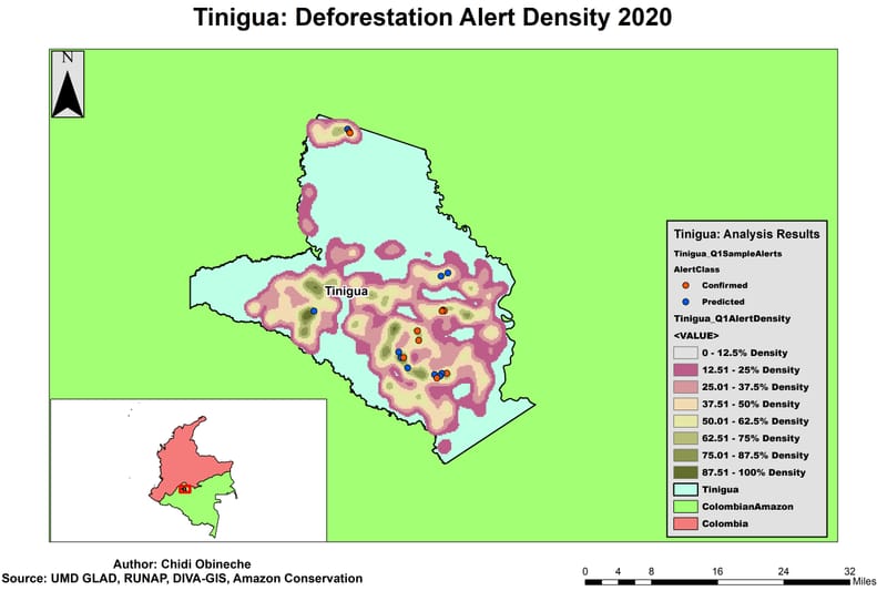
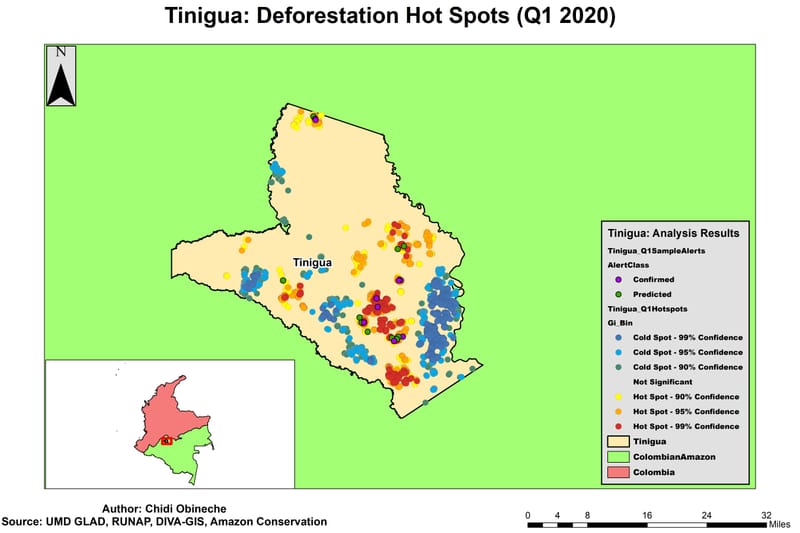
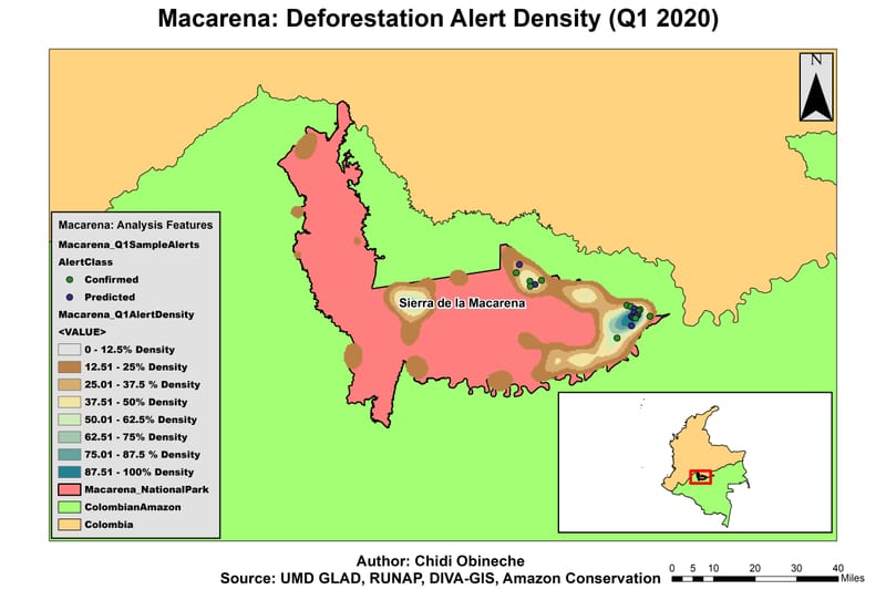
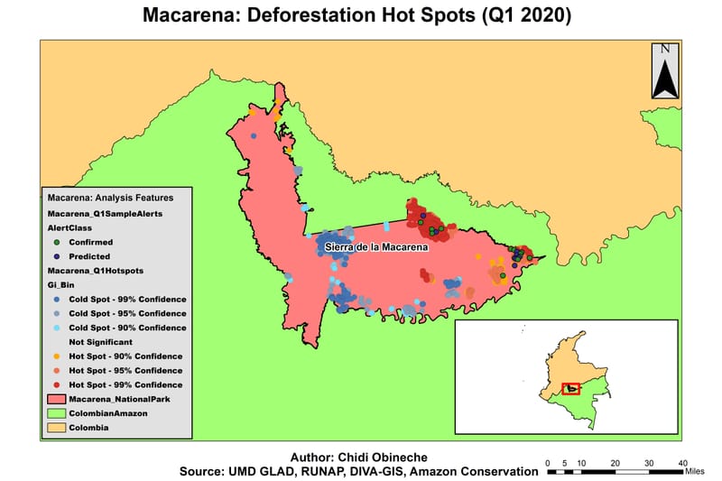
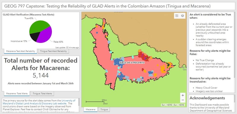
This was my capstone project based on the work I did during my internship with Amazon Conservation Association. The project involved using 20 alerts from the two protected areas of Tinigua and Macarena and listing them as True, False, or Inconclusive. I used Hot Spot Analysis and Kernel Density Analysis to determine what part of each protected area should I get the alerts from. The dashboard itself shows the results together which show roughly an equal amount of True and False alerts listed with a few inconclusive ones. Link to Dashboard (Esri account might be required to view): https://umdmpsgis.maps.arcgis.com/apps/opsdashboard/index.html#/3d100c7128044c389a1b0ed1b8ba4f8a
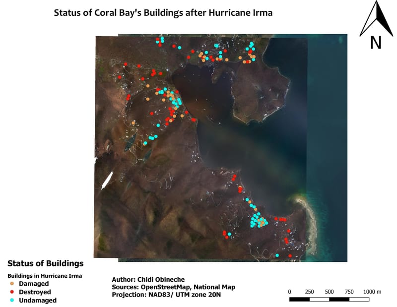
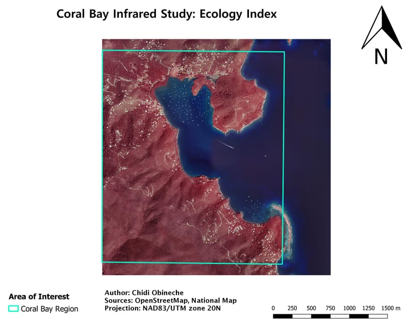
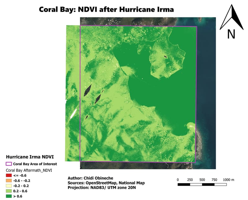
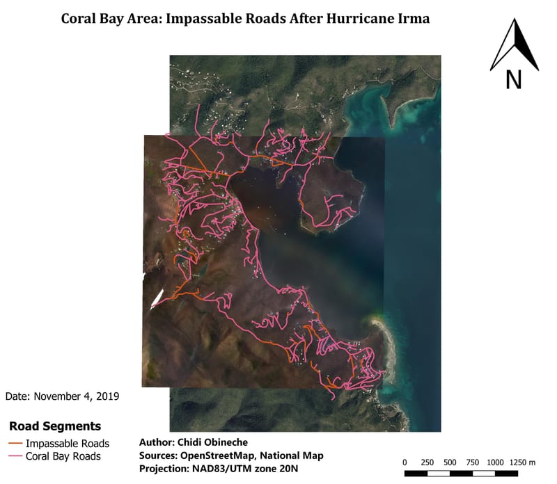
Hurricane Irma Assessment of Coral Bay
As part of my final class project for GEOG 661, I had to do an assessment of the damage caused to the Coral Bay region of the U.S. Virgin Islands by Hurricane Irma using GIS and Remote sensing. I was able to use remote sensing techniques to record the number of impassable roads and calculate the NDVI of the region before and after the storm . I was also able to pinpoint how many buildings were damaged, destroyed, or completely fine after the storm passed.